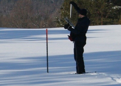
Snow depth and water content continue to measure above seasonal average at the snow survey sites measured by the North Bay-Mattawa Conservation Authority as part of its flood forecasting program.
“The light, fluffy snow contributes to the depth we’re seeing in the snow level. Water content is up from our last survey but it’s too early in the season to predict what the spring freshet will be like,” said Joel Harrison, Water Resources Specialist at NBMCA.
Snow is measured for depth and water equivalence in North Bay, Corbeil and Chisholm Twp. Data for the season can be found on the NBMCA website at www.nbmca.ca. The next snow survey date is February 1, 2017.
North Bay Golf and Country Club (Chippewa Creek Watershed, North Bay)
*Data prior to Dec. 2011 collected at the former Northeast Mental Health Centre, Hwy 11N
|
Current Average Snow Depth for January 16, 2017 |
47.3 cm (154% of normal) |
|
Current Average Water Equivalence for January 16, 2017 |
9 cm (136% of normal) |
|
Average Snow Depth for January 16, 2016 |
24.8 cm |
|
Highest recorded snow depth for January 3 since 2012* |
72.4 cm in 1990 |
|
|
|
Corbeil Conservation Area (La Vase River Watershed, Corbeil)
|
Current Average Snow Depth for January 16, 2017 |
47.3 cm (136% of normal) |
|
Current Average Water Equivalence for January 16, 2017 |
5.9 cm (102% of normal) |
|
Average Snow Depth for January 16, 2016 |
39.5 cm |
|
Highest recorded snow depth for January 16 since 1988 |
63 cm in 2009 |
|
|
|
Shirley Skinner Conservation Area (Kaibuskong River Watershed, Chisholm)
|
Current Average Snow Depth for January 16, 2017 |
45.3 cm (134% of normal) |
|
Current Average Water Equivalence for January 16, 2017 |
6.6 cm (110% of normal) |
|
Average Snow Depth for January 16, 2016 Highest recorded snow depth for January 16 since 2007 |
38.3 cm 52.1 cm in 2009 |


