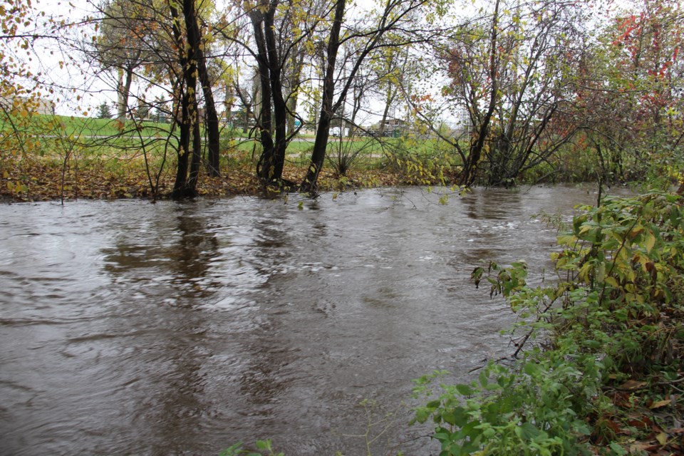
Heavy rainfall combined with snowmelt has caused water levels and stream flows to rise sharply today, reaching or exceeding the flood stage in many areas according to the MNRF.
A flood warning remains in effect, meaning flooding is imminent or occurring within specific watercourses and municipalities.
Rainfall today is expected to range from 10 to 50 mm.
City of North Bay works personnel are continuing to assess threat areas and are working to ensure drainage. Works, Fire and Police personnel are on alert for this weekend.
If North Bay residents need sandbags they will be available at the Public Works yard on Seymour says spokesman Gord Young.
"Road closures and sandbagging has been reported and area residents have been impacted by flooding," says an MNRF news release.
"Localized flooding has been reported on much of the southern portion of the District, which includes the Tomiko River, Sturgeon River, Upper French River, Mattawa River, Pickerel River, Wolf River, Restoule River, South River as well as creeks and streams that flow into sections of these respective watersheds.
"Lake Nipissing water levels are also increasing rapidly. There is the potential to reach the Maximum ‘Non-Damage’ Water Level of 196.22 on the lake by the middle of next week. There is also the possibility that water levels on the lake will exceed that mark later next week."
Lake Temiskaming and the Ottawa River system water levels are also rising rapidly, with the potential to affect Antoine Township, Mattawan Township, Thorne, McLaren’s Bay, Papineau/Cameron Township, and the communities bordering Lake Temiskaming.
In the northern reaches of the district which includes the Matabitchuan River and Montreal River watersheds, increased flows and water levels have been reported.
Continued melting of the snow pack coupled with forecasted precipitation and water/reservoir management will contribute to increased runoff and the potential for localized flooding.
Want to prepare/ Click here.
The Texas low-pressure system is expected to pull out of the province later Saturday.
Daytime temperature highs are 7 to 15 degrees centigrade for the next couple of days. Night-time temperature is forecast at five degrees to minus 6 degrees centigrade for the next few days moving into the weekend.
See How to Properly Fill and Stack a Sandbag below.


