Lake Nipissing water levels are increasing and are expected to reach the Maximum ‘Non-Damage’ Water Level of 196.22 on the lake by Friday says the MNRF in an update late this afternoon.
There is the possibility that water levels on the lake will exceed that mark into the weekend.
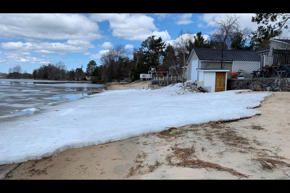
Some damage is already reported along the Lake Nipissing shoreline as shifting sheets of ice crash into the shoreline driven by the wind. Residents are urged to take advantage of free sandbags and sand offered to residents at the Public Works facility on Franklin St. to protest property from erosion as levels increase.
"We will see another Texas Low move towards the lower Great Lakes, bringing moist, unstable conditions to most of southern Ontario and into the North Bay area," according to the MNRF. "The system will bring periods of rain with the potential for heavier amounts, Tuesday evening into Wednesday. The current forecast for the North Bay MNRF District is showing rain, snow and or ice pellets ranging from 5-10mm over the next two days."
Most of the lower portions of northeastern Ontario have received substantial precipitation over the last week. The combination of repeated rainfall and snowmelt has resulted in water levels and stream flows across the area rising significantly, reaching or exceeded flood stage in many areas. Forecast precipitation for Tuesday and Wednesday will maintain or further add to existing high water conditions across most of the North Bay District.
Road closures and sandbagging has been reported and area residents have been impacted by flooding.
Localized flooding has been reported on much of the southern portion of the District, which includes the Tomiko River, Sturgeon River, Upper French River, Mattawa River, Pickerel River, Wolf River, Restoule River, South River as well as creeks and streams that flow into sections of these respective watersheds.
Lake Temiskaming and the Ottawa River system are expected to be affected by significant rainfall combined with snowmelt on the Ottawa River watershed, water levels all along the Ottawa River, and on Lake Temiskaming, will be well above normal conditions.
Municipalities and residents, especially those in low-lying areas and along shorelines, are encouraged to monitor these conditions and prepare accordingly. Shorelines and banks adjacent to rivers and creeks are very slippery and unstable at this time and, when combined with cold open water, pose a serious hazard.
Meanwhile, the OPP asking the public to stay away from the flooded areas unless a resident or directly involved with flood relief assistance.
"Touring the flooded areas can not only be a danger for yourself, but also for all the volunteers, resident owners and first responders assisting," says an OPP release.
"The affected areas are busy with traffic from sandbag deliveries, volunteers and resident owners attempting to quickly and efficiently do what they can to protect their property. Citizens 'touring' the areas slow this process down, hinder the effectiveness of this process and cause a danger to everyone around."


