An anticipated 20 to 30mm of rain over the next 24 hours has prompted the North Bay-Mattawa Conservation Authority to issue a Water Conditions Statement for water safety.
See: Store the shovel, dig out the umbrella
“As the system passes through, it’s expected to bring 20 to 30 mm of rain and temperatures of high single digits to low teens, adding melting snow to the runoff. The hard crust on the snow pack, together with the still frozen ground, will limit the absorption of the rainfall into the snowpack,” said Katelyn Lynch, NBMCA Duty Officer.
NBMCA’s March 31 snow survey revealed above average water content in the existing snow pack. Snow depths ranged between 30 and 39 cm in the NBMCA watersheds, translating to an average water equivalence between 96mm in the La Vase River subwatershed, 112mm in the Kaibuskong River subwatershed, and 125mm in the Chippewa Creek subwatershed.
“All this will cause increased runoff to watercourses and waterbodies, with higher than normal water levels throughout the North Bay-Mattawa region. Flooding is not anticipated at this time,” she added.
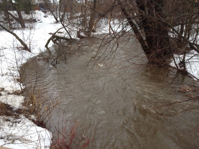
Banks adjacent to rivers and creeks are very slippery at this time and when combined with cold open water, pose a serious hazard. Parents are encouraged to keep their children and pets away from watercourses and off water bodies that have thinning, unsafe ice.
Flows and levels across Central Ontario are at moderate levels and are rising as a result of recent warm temperatures and rainfall. Continued snowmelt and runoff due to forecast warm temperatures and rainfall will result in flows and levels continuing to rise. Increasing flows and levels may result in river ice break-up and increase flood risk in areas prone to ice jamming. Recent warm temperatures and rainfall has resulted in saturated snowpack that is ready to release water content. Many areas that are free of snowpack are largely saturated and will readily produce runoff. Combined runoff from the rainfall and snowmelt as well as ice breakup may cause ponding and potential for flooding in low lying areas.
NBMCA is continuing to monitor weather and watershed conditions within its jurisdiction as the spring melt unfolds and provide updates if conditions change.
The general public is advised of these messages through www.nbmca.ca website with the flood status icon and a link to information about current conditions. NBMCA also issues these messages through local media and social media including twitter @theNBMCA and facebook.com/NBMCA.


