Yikes, I took to the backwaters in a motor boat! The destination was Lake Temagami it has more than 1,200 islands and it’s a special place and the following travelogue will tell the tale.
I was told being able to go boating, post-pandemic—or at any time, really—is an outdoors opportunity because studies show that being on or near the water is a boon for psychological health. That makes sense.
The proof might be in the book by Wallace J. Nichols, the author of ‘Blue Mind,’ it looks at scientific reasons why being in, on or under the water can make us happier and healthier. He says, “Simply the mere sight and sound of water promotes wellness by lowering cortisol, increasing serotonin, and inducing relaxation. He says, “When it comes to reducing stress, being on a boat can be considered a type of medicine.” Okay then it could be good for you.
We have an abundance of lakes in Northern Ontario but when you think about it there are not many boating destinations with facilities and services to meet the demands of “big water.” There is the North Channel (Killarney), Lake Temiskaming, Manitoulin Island (perimeter), Lake of the Woods, and Lake Nipissing (Upper and Lower French River leading into Georgian Bay). For boaters with large expensive pleasure crafts, there has to be an anchoring community, charts/maps, launches, marinas and a chip stand somewhere on the shoreline, accessible by boat. Not all lakes meet these criteria, so that is why, for example, Lake Nipigon is not on the list.
Background
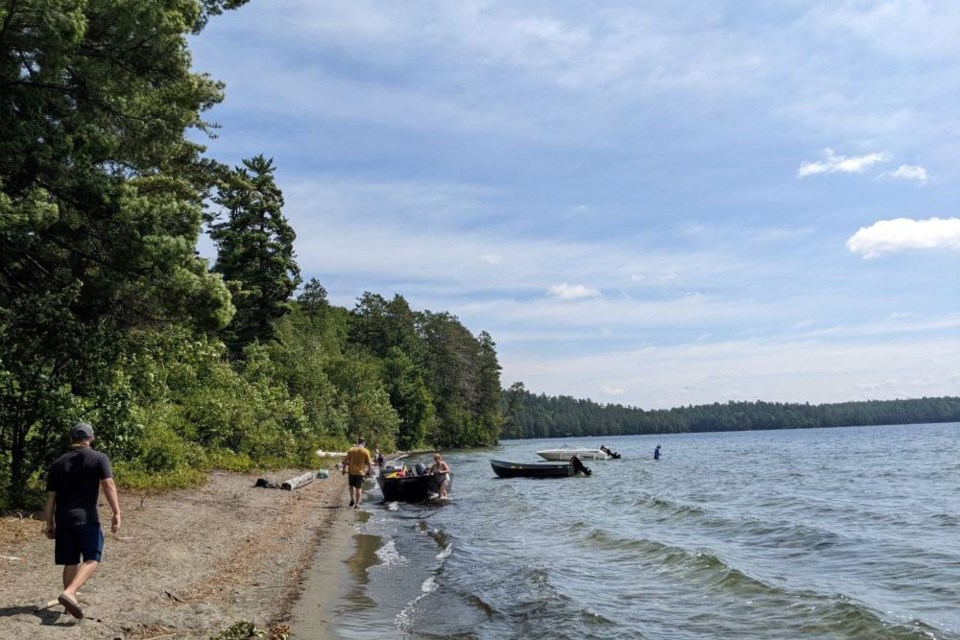
I was then convinced, through an invitation, to accompany Liz Mulholland and Brian Emblin from Timmins to tour Lake Temagami. It was one of the windiest days of the summer with the full-on sun. They have a gloss black, 16.25’ Lowe with a Yamaha 60 horsepower, it goes “like the wind.” Liz said, “it will be alright Bill it’s like canoeing in a hurry.”
The trepidation passed.
The province adopted the eastern white pine (Pinus strobus linnaeus) as an official symbol on May 1, 1984. The eastern white pine – which is the tallest tree in the province and can live over 250 years – represents Ontario's vast forests. This is Lake Temagami.
Arthur Lismer was fascinated by the Canadian landscape of rocks, pines, and expansive stretches of tumultuous water and sky. From 1920 he was a charter member of the Group of Seven, painters who advocated a new Canadian art that expressed the spirit of the nation through its landscape and this work of art ‘Temagami, Portage,’ this also Temagami. See the Artist Collective in Temagami.
In 1834, the Hudson's Bay Company opened a fur trading post on the lake, which operated during the 19th century. The Forest Reserves Act of 1898 established the Temagami Forest Reserve on the shores and adjacent lands of the lake in 1901. It was created to reserve the forests for future logging by restricting settlement.
In 1904 it was increased to 15,000 km2 (5,800 sq mi). As a result of this reserve, the building of cottages and resorts was only permitted on the lake's islands. This restriction is still in force today.
Lake Temagami is popular for cottage vacationing: the number of cottages/camps on Lake Temagami is estimated between 630 and 746. In addition, there are nine youth camps and 12 commercial lodges.
But first, as usual, some background people resources, there was a need to find out more through contacting those in the know.
Temagami First Nation (TFN)
Temagami First Nation’s (Bear Island) economic development officer Peter Mackenzie provided an overview from the first peoples' perspective.
Bear Island was likely one of the first places that humans (Teme-Augama Anishnabai ancestors) inhabited in the Temagami area, he said.
“They say this because Tower Hill is one of the highest points of land on Temagami Lake.
"The grandparents of the present-day Temagami First Nation began to reside on Bear Island during the summer when the Hudson Bay Post was established in 1872.
"Chief Tonene approached the Indian Agent and asked for a reserve in 1877. The Federal Government recognized that the Temagami Indians were missed in the Robinson Huron Treaty of 1850 and surveyed a reserve in and around Austin Bay.
"The Ontario Government refused to support the creation of a reserve in Austin Bay it was sold to the Federal Government.”
In 1970 at the request of the Chief and Council Bear Island became an Indian Reserve by an Order in Council of the Minister of Indian Affairs.
“Sportfishing has always been a major tourist attraction on Lake Temagami. Up until the mid-1970s, many men from our community operated as fishing/hunting guides in the Lake Temagami area.
"With the advancement of technology (e.g. fish finders, GPS, etc.) the demand for Indigenous guides is pretty much non-existent now. In more recent years, many Temagami First Nation members have started up their own businesses that have benefitted from tourism both directly and indirectly.
"Temagami First Nation members who operate construction companies on the lake have benefitted indirectly as tourists have visited the lake and had the means to build cottages in the area – Temagami First Nation member-owned contracting businesses have benefitted indirectly from tourism in this sense.
"There is definitely a market in the tourism industry for Temagami First Nation to be more involved possibly in outfitting for canoers, boating, sport fishers, hunters, etc. However, Temagami First Nation would need to develop more of a strategy and be more involved in the local tourism market.
"We have had community discussions about having more of a presence out in our traditional family territories with community support for outpost camps in our family territories. Outpost camps may have the possibility of being economic development opportunities as well.
"The community has opened up to the public now, but we ask that visitors to the community take precautions not to visit if they have been exposed to positive COVID cases and we have our own COVID protocols and measures we continue to follow to help keep our community safe.
"The local store is a privately owned business and it is open for business seven days a week during the summer months."
He also gave a fair warning.
“Lake Temagami is a popular boating destination because it is a large, deep lake in the middle of the wilderness that can be truly appreciated by adventurers and outdoors people.
"The lake can be dangerous for inexperienced boaters and it is advisable to have a shoal map while navigating the lake for those who are not familiar with the lake.”
Heritage Experience
Cathy Dwyer is Deputy Mayor of Temagami and has worked and lived on Lake Temagami for 60 years. She has some advice.
“Lake Temagami is a beautiful interesting lake and includes all the features one would be looking for in a boating adventure.
"But, it’s not for the novice boater. First, it is a labyrinth of bays, channels, islands and rocks, and can get very rough on windy days.
"While it is marked with red and green buoys, it is confusing as they switch depending on where you are on the lake. So having the Lake Temagami Shole map is imperative; it can be purchased at the local grocery store in the centre of town.”
Note the additional advice about having the map and a campsite map.
“There is no mainland development except for the bay in town, so cottages are only allowed on the islands. But not all islands are developed and some of the larger ones have very few cottages on them or none at all. So the ability to read a map is important because what looks like mainland may be an island.”
She cited Deer Island or Temagami Island with the old growth trails, which has very little development on the west side of the island.
She gave a virtual tour.
“The lake has two great beaches, Sand Point and Sandy Inlet. Sand Point is west of Bear Island whereas Sandy Inlet is at the very north end of Ferguson Bay.
"Sandy Inlet was home to the locally known oblate priest named Father Charles Paradis who visited the beach in 1880. Today it is popular with houseboat renters as it is a long beach with warm water and Camp Wanapitei is at the east end of the beach.
"On your way up to Ferguson Bay you will pass Camp Keewaydin, on Devil’s Island. The camp was founded in 1893 and is the world’s oldest canoe tripping camp. It also has the largest fleet of wood canvas canoes in the world and are still used for wilderness canoe trips.
"Most of the camps in Temagami still use wood canvas canoes, tumplines and wanigans."
The protected shoreline is covered with massive red and white pine, spruce, jack pine, birch and poplar. The water is clear and in Sharp Rock Inlet the water is especially blue.
“This is the route to get to the portage into Diamond Lake if you want to get into the backcountry by canoe. The best way to get up and close to the large pine trees is to walk the Temagami Island Old Growth Trails. There are other unofficial trails and areas but the Temagami Island Trails are the best.
"Many of the islands have interesting names, like Horseshoe, Devil, Rabbitnose, Stinking, Cattle, Kabekwabika, all steeped in history tied to the Indigenous people of the area. Lake Temagami is the heart and centre of the traditional territory of the Teme-Augama Anishinabai, Deep Water People.
"Lake Temagami flows south into the Temagami River and the Sturgeon River, Lake Nipissing, the French river and eventually reaching Georgian Bay of Lake Huron which is part of the Great Lakes Basin.
"Whereas many of Temagami’s other lakes flow into the Ottawa River basin via the Matabitchuan River which flows into Lake Temiskaming and then the Ottawa river. Temagami is situated on two great watersheds."
Final thoughts.
“It is easy to get lost, GPS and a depth finder are recommended.
"There is a free boat launch in the town of Temagami and at the end of the Lake Temagami Access Road which will get you into the centre of the lake. The lake has five main arms, the NE, N, NW, S and SW and you can’t see it all in one day.
"There are many campsites on the Crown Land shoreline that have been used for centuries.”
Why Wilderness?
Lake Temagami is a unique place for visitors to go boating, canoeing, and camping because the development you see occurs primarily on islands and the owners care; it is in good hands.
“This is due to municipal recognition of the 'Tenets for Temagami' (the Tenets) – a statement of land-use principles regarding maintenance of the mainland shorelines of Lake Temagami and Cross Lake in their natural states.”
The following is from Linda Bangay, Temagami Lakes Association Administrative Coordinator and Temagami Times Editor.
It is celebrating 91 Years: 1931 to 2022 and is dedicated to “preserving the natural environment and scenic beauty of Lake Temagmi.”
The 'Tenets' were developed and agreed upon by the former Township of Temagami, the Temagami Lakes Association, and the Lake Temagami Permanent Residents’ Association on March 8, 1994.
“This formed the basis for formal discussions regarding local governance, including the amalgamation of unorganized townships in the Lake Temagami area.
"A government study was completed, and on Jan. 1, 1998, the Municipality of Temagami was created by order of the Temagami/West Nipissing Restructuring Commission. The principles contained in the “Tenets” are included in the Municipality of Temagami’s Official Plan."
And there is a reason why the jagged skyline is not interrupted and will be for perpetuity. Within the following is the text of the “Tenets for Temagami” in its entirety:
“Skyline Reserve: The mainland surrounding Lake Temagami and Cross Lake is to be zoned as a landscape ecology zone to preserve the beauty, to restore the integrity, and to preserve the wilderness aspect/feeling of the Temagami Forest.
This ecology zone would consist of two reserves which would both be afforded protection from natural disturbance, such as fire and insect infestation, but would otherwise have separate management goals and prescriptions. A map of Lake Temagami will be drawn to illustrate the area that will be required to meet these objectives."
The Temagami Lakes Association is adamant about the following.
“The current ban on the construction of new public road access points to Lake Temagami and Cross Lake is supported by our three groups.
"We define the existing public road access points to consist of the Village waterfront, Finlayson Park, Strathcona Landing, and the Lake Temagami Access Road landings.
"We agree that, where possible, parking areas must be screened from the main body of the Lake. Shiningwood Bay, Cross Lake, Austin Bay, Bleu Bay, and any other illegal access points are to be closed using scarification methods as possible from Lake Temagami and Cross Lake.
"Existing gates are to be maintained, and new ones are to be installed to prevent new public access roads to Lake Temagami and Cross Lake.
"New ski-doo trails accessing Lake Temagami/Cross Lake are to be no wider than ten feet and zoned exclusively for winter ski-doo use.
"Proposals for these access points to Lake Temagami and Cross Lake are to be reviewed and sites inspected by the new governing body prior to construction.
“There should be no mainland development on Lake Temagami and Cross Lake with the exception of those potential lots immediately adjacent to the Township of Temagami that are able to be serviced by the Township’s central sewage treatment facility.
"All other future development will occur on islands, the number and location to be determined by the revised official plan, which will be sensitive to current ecological standards.”
That is why the skyline reserve will be maintained.
Tips
Here are some things to consider when planning a boating trip.
The municipal launch in the town, at the end of the Lake Temagami Access Road (there is a new cannabis shop – Ashkibgaa - 1.3 km from Highway 11– they work out of a shipping container), Boatline Bay Marine on the access road; Temagami Marine (commercial-64 years in operation) and a hidden gem we will look at next.
Dave Ward, Finlayson Point Provincial Park Superintendent, says the park is just off the highway and south of the town.
“The boat launch and vehicle parking area are available for use by seasonal pass and day use pass holders," he said. "The docks are available for rent by the day or for multiple days. Generally, the docks are used by people camping in the park who want to leave their boat in the slip throughout the stay.”
“Lake Temagami is a very large lake and Finlayson Point Provincial Park can be used as an access point by anyone with a day pass or seasonal pass," Ward said. "We do recommend proper navigation charts for anyone boating on Temagami. These can be purchased at the Finlayson Point Park Store.”
Beware of the long fetches creating white caps that can occur on some of the long stretches of the lake.
The lake is irregularly shaped with long north, northeast and southwest arms, shorter northwest and south arms and several smaller bays. The Northwest Arm leading to Obabika Inlet and Sharp Rock Inlet are sidebar boat adventures.
The Town of Temagami is located at the end of the northeast arm of the lake. It extends almost 50 km from north to south and about 35 km from east to west.
The lake's outflow is the Temagami River which in turn flows into the Sturgeon River.
A number of peninsulas are associated with the lake, such as the McLean, Cynthia and Joan peninsulas, as well as Sand Point, which separates the Northwest Arm from the rest of the lake. Extend exploration in the south by boating through the narrows and entering Cross Lake.
My pick, to get away from it all find the McLean Peninsula and Island Bay, it has many islands and the skyline there follows along an elongated ridge.
The Temagami Island trails are a must-do. It is the place to walk through towering giants of red and white pine. Six trails lead to sky-high old-growth pines that are used by island owners as their exercise routine tracks.
Here we met third-generation resident (Island #211) Luke Cashion from Washington D.C. He said he comes to the trails every year as a pilgrimage and for “the smell.”
This is a great barefoot walking opportunity. It is about one kilometre (an easy canoe) from the main hub-of-the-lake access point this is where at Loon Lodge the ice cream (the chip stand is closed) is located and gas; when on that day, was at European prices, $2.80/litre.
The two beaches (Sand Point being one) are destinations but particularly head for Ferguson Bay, it is a picnic destination. At the south end of the beach, you will see one of the older youth camps on the lake – Camp Wanapitei, established in 1931. To see Mount Ferguson Mountain find the campsite due south of the point of land entering the bay (see map); it is a shorter jaunt from there to the summit.
Temagami has more than 1,000 km of shoreline. Brian said our boating trip track equalled 130 'clicks' km. I'm still not used to paddling 50 k.ph. Here is the map.
I have also read the novel Loon by former Nipissing University professor Bill Plumstead, the setting is the lake and was made into the movie That Beautiful Somewhere (2006). A weathered detective teams up with a young female archaeologist to unravel the mysterious death of a 'bog body' found in a native swamp rumoured to have curative powers. It is a story of two wounded souls searching for healing and redemption. Lake Temagami is a beautiful somewhere for you to discover.
It was fun. Back roads do lead to backwaters and it is good medicine.


