Update 4 p.m.
Current details:
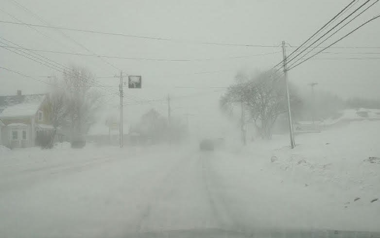
Snow squalls are expected. Under the snow squall bands, visibilities will be significantly reduced due to the heavy snow, and snow will quickly accumulate.
Some lake effect flurries are affecting areas close to Georgian Bay this afternoon, mainly near and north of Parry Sound. Weather radar shows that the activity is slowly intensifying. The snow squalls are expected to be fairly strong through the night while slowly drifting southward.
Local snowfall amounts of 15 cm are possible.
The snow squalls are expected to shift southeast of Georgian Bay Tuesday morning and weaken.
Snow squalls cause weather conditions to vary considerably; changes from clear skies to heavy snow within just a few kilometres are common. Visibility may be suddenly reduced at times in heavy snow.
-----
Snow squall watch issued for:
- Huntsville - Baysville,
Current details:
Snow squalls are expected to develop. Under the snow squall bands, visibilities will be significantly reduced due to the heavy snow combined with blowing snow, and snow will quickly accumulate.
Conditions are favourable for snow squalls to develop this evening and continue into early Tuesday morning. Local snowfall amounts of 15 cm are possible.
Snow squalls cause weather conditions to vary considerably; changes from clear skies to heavy snow within just a few kilometres are common. Visibility may be suddenly reduced at times in heavy snow.
Snow squall watches are issued when conditions are favourable for the formation of bands of snow that could produce intense accumulating snow or near zero visibilities.


