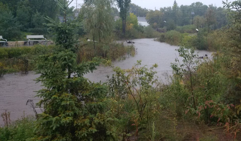
You should keep a close watch on conditions and exercise caution around rivers and streams over the next few days says the Ministry of Northern Development, Mines, Natural Resources and Forestry.
Keep an eye on children especially, says a news release.
The forecasted rain for tonight through Wednesday could cause a rise in water levels.
A cold front and a moisture-laden low-pressure system from the American mid-west is forecast to bring significant rainfall to the district over the next couple of days.
This system is expected to bring rainfall accumulations of 40-60mm before Thursday morning with an additional 10-25mm each day if local thunderstorms develop.
Following the low-pressure system, unsettled weather will continue through to Saturday, resulting in a cumulative five-day total rainfall of 90-100mm. Winds are expected to be from the S-SW at 20km/h on the eastern side of the system, and from the N-NE at 30-40km/h on the western side of the system starting today through Wednesday.
"Water levels throughout the district are average for this time of year but can rise rapidly with a significant rainfall," says the release. "Rainfall over the next couple of days could create possible flooding in low-lying areas with a history of flooding. Residents in these areas are encouraged to monitor conditions and prepare accordingly.
Persistent rainfall in the forecast for the next five days and beyond could result in elevated stream flows creating risks such as very slippery, unstable, and eroding shorelines and riverbanks. When combined with high and fast-moving water, these conditions pose a serious hazard.


