Residents of Katrine are hopeful a public meeting with the Ministry of Natural Resources and Forestry (MNRF) will shed light on why water levels at Doe Lake are higher than water levels at nearby lakes.
Adam Wakefiled, the MNRF's district manager for the Parry Sound District, will be at the Katrine Community Centre answering the public's questions on Aug. 18.
Armour Mayor Bob MacPhail says residents are concerned about the water levels and he has told Wakefield to expect hard questions from ratepayers.
MacPhail told his council Aug. 9 that Ahmic Lake and Cecebe Lake are allowed to operate within a 10-centimetre range with their levels but levels on Doe Lake can sometimes fluctuate as much as 60 cm.
MacPhail told his council members that Wakefiled is going to have to convince ratepayers that allowing a 60 cm operating range at Doe Lake is legitimate when everyone else is only allowed to operate within a 10 cm range.
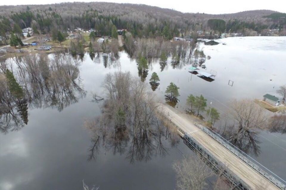
Doe Lake has been the site of several flooding events after significant rainfalls to the point that docks owned by marine operators and private cottage owners have been damaged.
See: Almaguin's Doe Lake high water levels are causing damage
In 2019 there was major flooding. The nearby Ferguson Road in Katrine was flooded, including the Doe Lake Municipal Park.
MacPhail last August said there was a belief in the community that the flooding is the result of how the MNRF handles the removal and reinstallation of logs at the Watt's Dam to control water levels ahead of rainfalls.
The Watt's Dam issue may be raised on Aug. 18.
The meeting begins at 7 p.m.
The Katrine Community Centre is located at 6 Browns Dr. in Katrine.
Katrine residents can also participate via Zoom. Go here for information on how to log in.
Rocco Frangione is a Local Journalism Initiative reporter who works out of the North Bay Nugget. The Local Journalism Initiative is funded by the Government of Canada.


