Update 9:a.m.
Blowing snow advisory issued for:
- North Bay - West Nipissing,
- Greater Sudbury and vicinity,
Poor visibility in snow and blowing snow is expected or occurring in some locations.
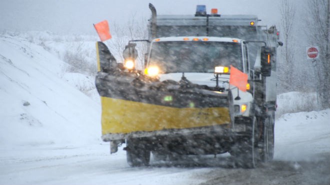
Radar indicates an area of snow which has stalled between Sudbury and North Bay. This combined with blustery northeast winds gusting up to 50 km/h is resulting in poor visibilities along the roadways including the Trans-Canada Highway. Poor visibilities are expected to persist into the early afternoon.
Travel is expected to be hazardous due to reduced visibility.
If visibility is reduced while driving, turn on your lights and maintain a safe following distance.
Blowing snow advisories are issued when winds are expected to create blowing snow giving poor visibility to 800 metres or less for at least 3 hours.
-----
Original Story:
Yesterday it looked like we were going to avoid that Alberta Clipper, but Environment Canada says we're back in range today.
It's issued a Special weather statement for:
- North Bay - Powassan - Mattawa,
- Greater Sudbury and vicinity,
- West Nipissing - French River,
- Burk's Falls - Bayfield Inlet
- Huntsville - Baysville,
Accumulating snow associated with an Alberta Clipper continues today.
An additional 5 to 10 cm is expected before the snow ends this evening.
Gusty northerly wind will also develop this morning and afternoon, which will lead to locally reduced visibility in blowing snow.
Poor winter driving conditions are expected from the general snowfall, and then from occasional low visibility in blowing snow today.


