That heavy snowfall over the winter, and a spring dominated by rain has the potential to cause some major headaches in the North Bay area.
Lakes and rural watercourses, already swollen, and in some cases flooding from melting snow, rain and runoff, could see up to 50mm of rain in the coming week.
That's prompted the North Bay-Mattawa Conservation Authority to expand the "Flood Warning" to include Lake Nipissing.
It's not just water that is of concern.
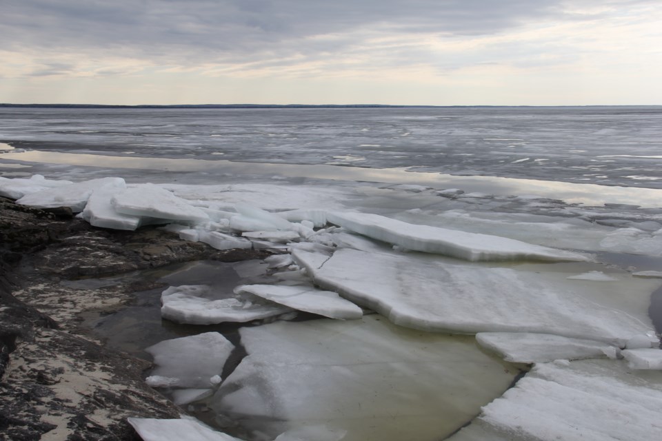
A westerly wind and high lake levels could create plenty of damage to property as ice crashes into the shoreline, destroying docks, decks, and even some buildings.
“It is also expected that Lake Nipissing will reach 196.0m, 15cm above the summer operating level, by this weekend," said Kurtis Romanchuk, NBMCA’s Duty Officer.
"Lake Nipissing is also forecasted to reach 196.22m, the flood limit at which damages may begin to occur, by May 2. This may pose a threat to properties along the Lake Nipissing and Callander Bay shoreline, particularly if there are strong winds or waves.
“NBMCA is preparing to operate the backflood control structure on Parks Creek, if needed, to prevent the rising waters from Lake Nipissing from flowing upstream into Parks Creek,” he added.
A "Flood Warning" means that flooding is imminent or already occurring in specific watercourses or municipalities. Municipalities and individuals should take action to deal with flood conditions including road closures and evacuations.
Since April 18, more than 55mm of precipitation has fallen, and more than 100mm of snow-water-equivalence has melted, according to the Authority. Between 10 and 30mm of rain is forecast for tomorrow, and up to 50mm through this week.
Information about the current status of Lake Nipissing may be found at the Public Services & Procurement Canada website.
Flooding is already occurring in low-lying areas around lakes and watercourses, particularly along large rural systems where runoff is accumulating.
Wasi Lake, Trout Lake, Lake Talon, Lake Nosbonsing, and other lakes along and near the Mattawa River are currently experiencing very high water levels, and water levels will likely continue to rise with the forecasted rainfall. Urban watercourses including Chippewa Creek may experience a quick rise in response to an intense rainfall event.
Although there is flooding in low lying areas along the Mattawa River, there are currently no concerns regarding backwater flooding in Mattawa from the rising water levels in the Ottawa River. Information about the current forecast water levels for the Ottawa River may be found at the Ottawa River Regulation Planning Board website:
Road closures and sandbagging has been reported and area residents have been impacted by flooding says a report from the MNRF.
"Localized flooding has been reported on much of the southern portion of the District, which includes the Tomiko River, Sturgeon River, Upper French River, Mattawa River, Pickerel River, Wolf River, Restoule River, South River as well as two creeks and streams that flow into sections of these respective watersheds."
Ice and water flow conditions are already hazardous and conditions will become even more so wherever creeks or rivers enter lakes. Banks adjacent to rivers and creeks become very slippery with precipitation and melting conditions. Parents are encouraged to keep their children and pets away from watercourses and waterbodies.


