 The North Bay-Mattawa Conservation Authority has released its first snow pack data for the watershed as part of its Flood Forecasting and Warning Program.
Recent snowfall has resulted in an accumulation of snow and a measurable snow pack that, based on the weather forecast, is here to stay.
Snow levels and water content values vary across the snow survey stations, with all stations recording values that are slightly below normal for this time of year.
The Authority will continue with its bi-weekly monitoring of the snow pack throughout the winter and into spring of 2015.
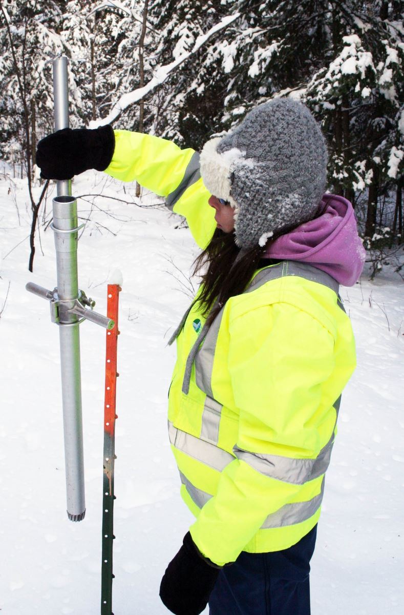
Snow is measured for depth and water equivalence at three locations in the watershed.
Data for the season can be found on the NBMCA website at www.nbmca.on.ca.
North Bay Golf and Country Club (Chippewa Creek Watershed, North Bay)
Current Average Snow Depth for December 15, 2014 12.0 cm (81% of normal)
Current Average Water Equivalence for December 15, 2014 1.9 cm (68% of normal)
Average Snow Depth for December 15, 2013 12.6 cm
Highest recorded snow depth for December 15 since 1988 46.2 cm in 2008
Corbeil Conservation Area (La Vase River Watershed, Corbeil)
Current Average Snow Depth for December 15, 2014 13.5 cm (70% of normal)
Current Average Water Equivalence for December 15, 2014 2.3 cm (99% of normal)
Average Snow Depth for December 15, 2013 22.4 cm
Highest recorded snow depth for December 15 since 1987 43.2 cm in 1995
Shirley Skinner Conservation Area (Wasi River Watershed, Chisholm)
Current Average Snow Depth for December 15, 2014 22.1 cm (88% of normal)
Current Average Water Equivalence for December 15, 2014 2.89 cm (74% of normal)
Average Snow Depth for December 15, 2013
Highest recorded snow depth for December 15 since 2006 22.2 cm 42.7 cm in 2010


